
How to Read a Survey Plan in Trinidad and Tobago
Read a survey plan by first identifying the parcel, surveyor, date and record references. Then examine the boundary measurements, marks, area, adjoining land and any notes or approvals. Read it alongside the deed or title documents. A plan supplies survey information; questions about ownership, access rights and permission to develop require the corresponding legal and planning records.
Read the complete surveying guideStep 1: identify the parcel and the version of the plan
Locate the description of the land, locality and parcel or lot number where shown. Match these with the property schedule and the survey reference in the deed or title papers. A lot number is meaningful within its particular parent parcel or layout; the same number can appear in many unrelated developments.
Check the survey date, drawing references, revisions and any description of the plan’s purpose. Ask the responsible professional whether it represents an existing parcel, a proposed subdivision, a redefinition or another survey task. Retain the whole plan, including margins and endorsements. A cropped photograph can omit information needed to interpret it.
Step 2: distinguish the different reference numbers
Record each reference exactly as printed, including letters, separators and year where present. Tell the receiving office which document the reference came from. Do not assume that a deed number can be used as a survey plan number.
| Reference | What it helps identify | How to use it |
|---|---|---|
| Survey plan registration number | A plan recorded by Surveys and Mapping. | Quote it when asking the Division to locate that plan. |
| Cadastral sheet reference | The relevant cadastral mapping sheet. | Use it with the parcel location and other records to assist a search. |
| Lot or parcel number | A parcel within the particular survey or layout. | Match the parent property and plan as well as the number. |
| Deed registration number | An instrument in the deed records. | Use the Land Registry search route for the instrument. |
| Volume and folio | A reference used in the RPA title system. | Use it to identify the title record through the appropriate Registry service. |
| Planning application or approval reference | A planning file or decision. | Check the decision, approved drawings and conditions with the planning records. |
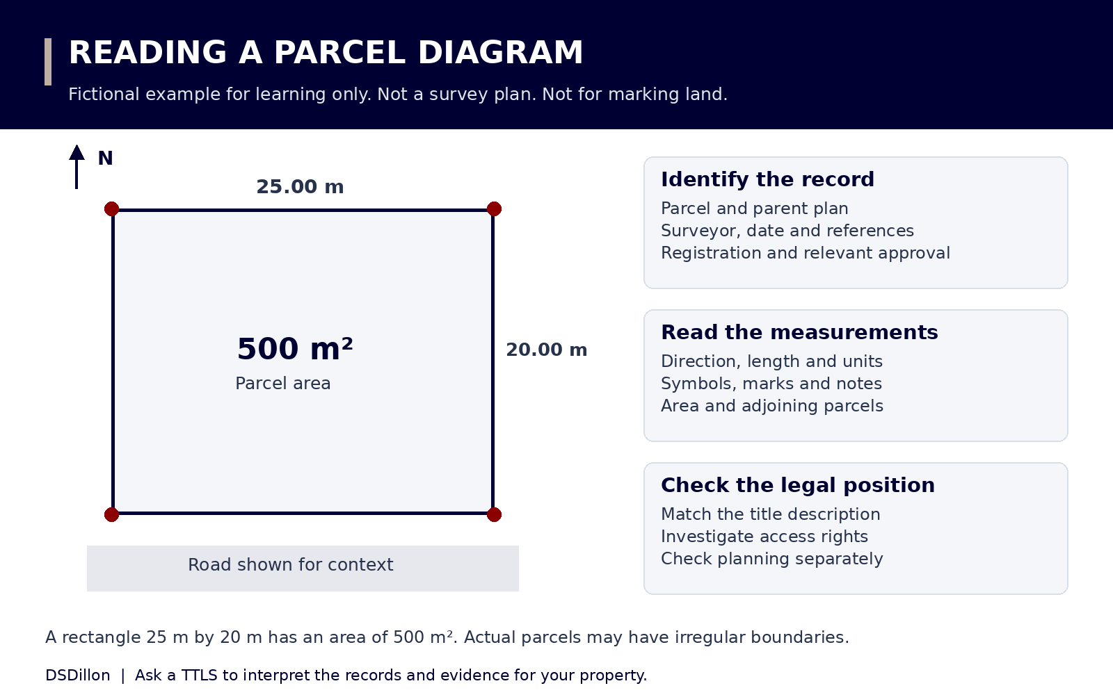
A simple guide to the information on a plan
The illustration uses a fictional rectangular parcel to explain how dimensions, area and orientation relate. Actual plans can have irregular boundaries, different symbols and additional notes. It is not a survey plan and must not be used to identify or mark land.
Step 3: read the boundary lines, bearings and dimensions
Work around the parcel boundary in sequence. A bearing describes a line’s direction; a distance describes its length. Read the units and the plan’s stated orientation. Do not assume that every line, arrow or number on the sheet defines a property boundary.
Check the north indicator, scale, legend and explanatory notes where provided. Ask the surveyor to explain unfamiliar symbols, abbreviations and any distinction between recorded and newly measured information. Use stated dimensions for reading the document. Measuring a resized photograph or print with a ruler can give a misleading result.
Regulation 35 gives particular significance to the original boundary marks when an existing boundary is surveyed again. Interpretation therefore involves the underlying evidence as well as the figures on the drawing. A reader cannot relocate a corner by choosing whichever dimension seems preferable.
Step 4: check the area and its units
Confirm whether the stated area describes the whole parent parcel or the particular lot. Check the units before comparing the survey with an advertisement, valuation or sale agreement. Area alone cannot identify a parcel: different shapes and locations can have the same area.
One hectare is 10,000 square metres. One acre is approximately 4,046.86 square metres; one square metre is approximately 10.7639 square feet. These conversions explain units and do not resolve a discrepancy between two surveys.
Where a re-survey shows different boundary lengths or areas, Regulation 36 requires the surveyor to demonstrate that the difference is not due to encroachment on or by adjoining parcels. Refer a material difference to the surveyor and attorney before relying on a sale description.
Step 5: examine marks, occupation, adjoining land and access
Identify the marks referred to on the plan and ask which were found, placed or re-established. A fence, wall, hedge or occupied line can be relevant evidence, but its presence does not by itself establish the legal boundary. Do not move a peg to make the site match your reading of the drawing.
Look for adjoining parcels, roads, reserves, drains and any marked right of way or easement. Ask the attorney to check the legal access and relevant title instruments. The depiction of a track or road does not, by itself, establish your right to use it or the width of that right.
Ask whether the survey’s scope included existing buildings and other improvements. Their omission from a particular plan should not be taken as proof that they do not exist. A designer may need a separate or expanded topographical survey.
Step 6: check certification, registration and the applicable approval
Identify the TTLS responsible for the plan and check the person’s registration. Regulation 42 requires the surveyor’s seal and certification, and prohibits certification of a survey that the person neither performed nor supervised.
For a plan attached to a document tendered for land or title registration, section 25 requires TTLS certification and registration with the Director of Surveys. RPO plans go through checking and DOS approval; Old Law plans do not require DOS approval under the Division’s published procedure.
Ask for the actual record of each relevant step. A surveyor’s certification, a plan registration reference, DOS approval where required, and a TCPD planning permission answer different questions.
How do you obtain a copy of an existing survey plan?
First, check the property file held by the owner, attorney or original surveyor. Note the surveyor’s name, date, plan reference, cadastral sheet and parcel description. If the plan cannot be found, take the available information to Surveys and Mapping so the appropriate records can be searched.
The published Survey Plan Vault service describes an in-person request for cadastral sheets, survey plans and other survey records. Before travelling, confirm the current request location, what identification or authority the office requires, the available copy format and charges. Tell the office if the receiving attorney or authority requires a certified copy and ask whether that form of copy is available.
Obtain a complete, legible copy with its relevant endorsements. Compare it with the reference in the title file. A retrieved historical plan records that survey; ask the surveyor whether further work is needed for the present transaction or development.
Does an old survey plan expire? Do I need a new survey?
The date on a plan tells you when the survey or drawing was made. It does not establish that the document is suitable for every later purpose. An older plan can remain relevant historical evidence while failing to show later subdivision, changed occupation or current site features.
Ask the attorney, lender, designer or receiving authority what is required for the particular transaction. Have a TTLS assess whether the existing evidence is sufficient or whether a re-survey, redefinition or additional survey information is needed. Do not rely on an assumed universal expiry period or replace a plan solely because it is old.
Can I use an online cadastral map or phone GPS?
The Surveys and Mapping geoportal provides access to spatial information. Use its layers and metadata to understand the data being displayed. For an authoritative boundary enquiry, obtain the relevant survey records and engage a TTLS.
A screen outline, aerial image or phone location is insufficient to decide where to build a fence or to settle an ownership dispute. Compare the registered records, survey evidence and legal documents through the appropriate professionals.
Questions to take to your surveyor and attorney
Bring the complete plan and title papers to the discussion. Ask for explanations of unresolved differences in writing so that everyone working on the transaction uses the same parcel description.
- Does this plan identify the exact parcel being offered?
- Which boundary marks were found, and are any missing or disturbed?
- Do the area, measurements and occupation agree with the relevant records?
- What legal documents establish access or other rights shown?
- Is the required plan registration or approval complete?
- What further survey information or planning permission is needed for my purpose?
Discuss your land project
Tell us the location, the documents you hold and the development you have in mind.
Contact DSDillonThis guide provides general information. Obtain advice on the title, lease, site and approvals for your particular proposal.